Cambridge, November 27, 2012
There is only one map of Istanbul I
know of that shows the chains of the Golden Horn. I'm sure there are others, but this one comes from the Liber
Chronicarum (Book of Chronicles) by the German historian and cartographer
Harmann Schedel. Better known as
the Nuremberg Chronicle, the book is a history of the world; yes, from the
Genesis all the way to the time of its publication in 1493. I wouldn't be surprised if Schedel's
Chronicarum were the first printed urban history, as the book includes descriptions
and illustrations of something like sixty cities (with various degrees of verisimilitude.) The woodcuts (more than 1,800 in
total!) came from Michael Wolgemut, a painter and printmaker that ran a large
workshop in Nuremberg (the young Albrecht Dürer was an apprentice of in Wolgemut's workshop during the
years preceding the publication of the book, so it's not inconceivable that
some of the images may have come from Dürer's own hand.)
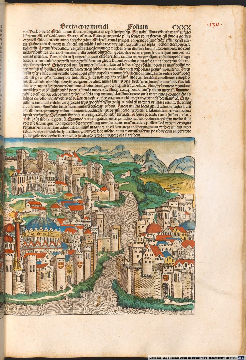
Schedel chronicles the 1453 fall of
Constantinople to armies of the Ottoman Sultan Mehmed II, fresh news at
the time, you could say. Folio
130 includes a double spread map--more like a frontal perspective--of
Constantinople with a great deal of detail. If you look towards the bottom of the right page, you can
see not one but two chains anchored to the fortifications surrounding Hagia Sophia
(unmistakable in the sheer size of the dome) and then dipping into the waters of the
Golden Horn. One is almost at the
point where the estuary opens to Bosphorus and the other further
inland.
No comments :
Post a Comment